Cotowa – ことわ

  • Cotowa

Search

Category

Cotowa

Category

  • Hiking Course Map
  • Walking Course Map
  • Park & Garden Map
  • Tokyo Travel Guide
  • Activity Report
  • Blog

Popular Articles

  1. オフラインのためランキングが表示できません

  • Newest First
  • Sorted by Popularity
Hiking Course Map
  • 2017-04-05

【Hiking Course Map】Mount Takao Trail No.6 – 高尾山6号路マップ

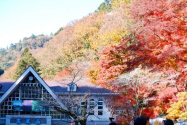
Tokyo Hiking Course Guide 東京日帰り登山・コースマップ|高尾山6号路 Average Time: 3 hoursDistance: 8 kmElevation: 599 mL […]

Read More
Hiking Course Map
  • 2017-04-05

【Hiking Course Map】Mount Takao Trail No.1 & 4 – 高尾山1号路・4号路マップ

Tokyo Hiking Course Guide 東京日帰り登山・コースマップ|高尾山1号路・4号路 Average Time: 3 hoursDistance: 7.5 kmElevation: […]

Read More
Tokyo Travel Guide
  • 2017-03-25

【Meeting Place】Ikebukuro Station – West Exit 池袋駅西口待ち合わせ

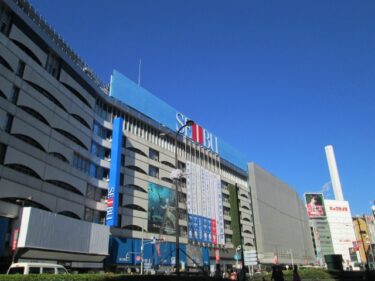
Useful Meeting Place 待ち合わせ場所|池袋駅西口 The Meeting Place・Owl Statues next to West Exit of Ikebukuro Stat […]

Read More
Tokyo Travel Guide
  • 2017-03-25

【Meeting Place】Ikebukuro Station – East Exit 池袋駅東口待ち合わせ

Useful Meeting Place 待ち合わせ場所|池袋駅東口 The Meeting Place・Police Station close to East Exit of Ikebukuro […]

Read More
Tokyo Travel Guide
  • 2017-03-20

【Meeting Place】Nippori Station 日暮里駅待ち合わせ

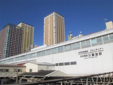
Useful Meeting Place 待ち合わせ場所|日暮里駅北改札口 The Meeting Place・JR North Gate of Nippori station How to get […]

Read More
Tokyo Travel Guide
  • 2017-03-20

【Meeting Place】Shinagawa Station 品川駅待ち合わせ

Useful Meeting Place 待ち合わせ場所|品川駅中央改札 The Meeting Place・Triangle Clock at JR Central Gate of Shinagaw […]

Read More
Park & Garden Map
  • 2017-03-10

【Park & Garden Map】Tsurugaoka Hachiman-gu Shrine – 鶴岡八幡宮

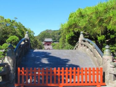
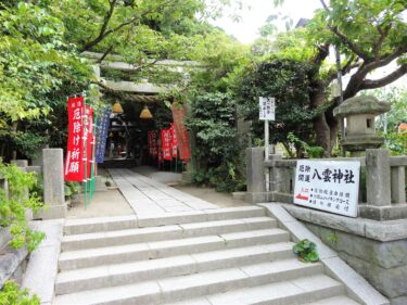
Tokyo Park & Garden Guide 東京日帰り散歩・街歩きガイド|鶴岡八幡宮 Location: Kamakura City, KanagawaAccess: Kamakura […]

Read More
Hiking Course Map
  • 2017-03-05

【Hiking Course Map】Kamakura Kinubari-yama – 鎌倉衣張山ハイキングコース

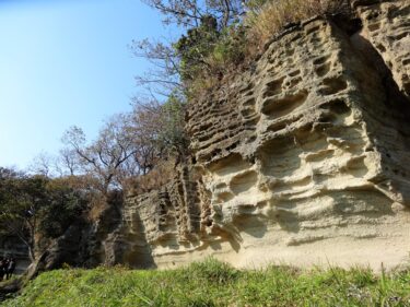
Tokyo Hiking Course Guide 東京日帰り登山・コースマップ|鎌倉衣張山 Average Time: 4 hoursDistance: 6 kmElevation: 120 mLe […]

Read More
Hiking Course Map
  • 2017-03-05

【Hiking Course Map】Kamakura Gion-yama – 鎌倉祇園山ハイキングコース

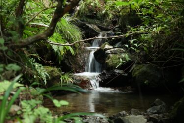
Tokyo Hiking Course Guide 東京日帰り登山・コースマップ|鎌倉祇園山 Average Time: 3 hoursDistance: 4 kmElevation: 60 mLev […]

Read More
Hiking Course Map 鎌倉大仏
  • 2017-03-05

【Hiking Course Map】Kamakura Daibutsu Trail (Great Buddha Statue) – 鎌倉大仏ハイキングコース

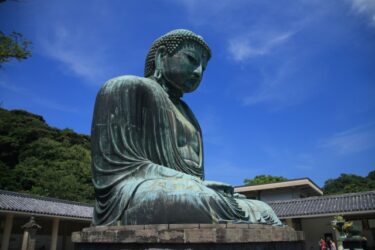
Tokyo Hiking Course Guide 東京日帰り登山・コースマップ|鎌倉大仏・源氏山 Average Time: 3 hoursDistance: 5.5 kmElevation: 93 […]

Read More
  • Prev
  • 14
  • 15
  • 16
  • 17
  • 18
  • Next

Search

Category

  • Hiking Course Map
  • Walking Course Map
  • Park & Garden Map
  • Tokyo Travel Guide
  • Activity Report
  • Blog

New Articles

  • 【Hiking Course Map】Mt. Tonosu & Azuma Gorge – 多峯主山&吾妻峡ハイキングコース
  • 【Hiking Course Map】Mount Kobo – 弘法山ハイキングコース
  • 【Hiking Course Map】Hatonosu Valley – 鳩ノ巣渓谷ハイキングコース
  • 【Hiking Course Map】Mitake Gorge – 御岳渓谷ハイキングコース
  • Holiday Rapid Akigawa – How to get to Musashi-Itsukaichi Station

Archive

© Copyright 2025 Cotowa – ことわ.