Tokyo Hiking Course Guide
東京日帰り登山・コースマップ|鳩ノ巣渓谷
Average Time: 3 hours
Distance: 5 km
Level: Beginner
About the Course – Hatonosu Valley
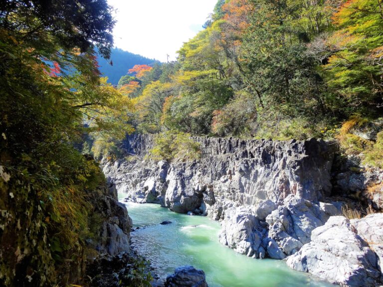
Hatonosu Valley is located in Okutama area in western Tokyo.
Mountain streams flow through huge rocks in the narrow valley.
The course goes along Tama river to the valley. In the middle of the course there is a small dam, where you can see fine views of the river from the top.
The course is not difficult. It’s well-maintained and suits for beginners.
Course Map
- Oku-Tama Station 奥多摩駅
- Showa Bridge 昭和橋
- Higashi-nagahata Bridge 東長畑橋
- Entrance of the Trail 数馬峡遊歩道入口
- Kazuma West Tunnel 数馬西トンネル
- Kazuma Valley 数馬峡谷
- Lake Shiromaru 白丸湖
- Shiromaru Dam 白丸ダム
- Observation Deck 展望台
- Shiromaru Dam Fish Way 白丸魚道
- Hatonosu Small Bridge 鳩ノ巣小橋
- Hatonosu Valley 鳩ノ巣渓谷
- Tamagawasui Shrine 玉川水神社(水神宮)
- Soryu Fall 双竜の滝
- Unzen Bridge 雲仙橋
- Hatonosu Station 鳩ノ巣駅
Google Map
【External Links】
・O-Tama Walking Trail Map (PDF・English)
・Okutama Tourist Office (Japanese)
・Information on Trail Condition (Japanese)
