Tokyo Hiking Course Guide
東京日帰り登山・コースマップ|鎌倉大仏・源氏山
Average Time: 3 hours
Distance: 5.5 km
Elevation: 93 m
Level: Beginner
About the Course – Kamakura Daibtsu Trail
The hiking course goes through a small mountain called Genji-yama. The mountain is very low and easy to climb. There are some good view points from the mountain.
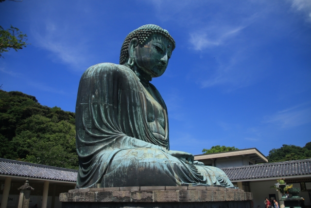
The course goes to Kotoku-in temple where is famous for a big statue of Buddha.
The hiking course is very easy, and suits for beginners.
Course Map
1. Kita-Kamakura Station 北鎌倉駅
2. Jochi-ji Temple 浄智寺
3. Kuzuharaoka Shrine 葛原岡神社
4. Genjiyama Park 源氏山公園
5. Statue of Minamoto-no Yoritomo 源頼朝像
6. Zeniarai Benzaiten Shrine 銭洗弁財天
7. Cafe Itsuki Garden 樹ガーデンカフェ
8. Kotoku-in Temple 高徳院
9. Hase-dera Temple 長谷寺
10. Hase Station 長谷駅
Course Map (Google Map)
