Tokyo Hiking Course Guide
東京日帰り登山・コースマップ|鎌倉衣張山
Average Time: 4 hours
Distance: 6 km
Elevation: 120 m
Level: Upper Beginner
About the Course – Kinubari Mountain
The course goes to the small mountain called Kinubari-yama in the eastside of Kamakura city. On the course there are some fine view spots where you can see Kamakura beach (Yuigahama) under your eyes.
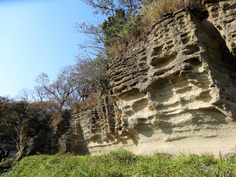
The course passes through Nagoe-kiridoshi trail, which was built by scraping rocks in the middle age. Even though the trail is very narrow, it was used as one of main streets in Kamakura era (12th~14th Century). Along the trail there are some historical sites of tombs and quarries.
Course Map
1. Kamakura Station 鎌倉駅
2. Hongaku-ji Temple 本覚寺
3. Myohon-ji Temple 妙本寺
4. Ankokuron-ji Temple 安国論寺
5. Chosho-ji Temple 長勝寺
6. Entrance of Nagoe-kiridoshi Trail 名越切通・大町口
7. Mandara Tumuli まんだら堂やぐら群
8. Nagoe Pass 名越切通・第1切通
9. Historical Tombs 石廟
10. Osarubatake Historical Quarry Site お猿畠の大切岸
11. Observation Area 水道山展望台
12. Nature Park 鎌倉市子ども自然ふれあいの森
13. Entrance of Kinubari Mountain Trail 衣張山山道入り口
14. Kinubari Mountain 衣張山
15. Historical Quarry Site 石切り場跡
16. Exit of the Trail 平成巡礼道
17. Sugimoto-dera Temple 杉本寺
18. Sugimoto-kannon Bus Stop 杉本観音バス停
Course Map (Google Map)
