Tokyo Hiking Course Guide
東京日帰り登山・コースマップ|鎌倉源氏山
Average Time: 3 hours
Distance: 4.5 km
Elevation: 93 m
Level: Beginner
About the Course – Genji-yama
In the north part of Kamakura, there is a small and low mountain called Genjiyama. The elevation is only 93 meters high.
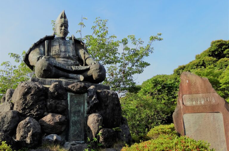
There is a park on the top of the mountain. The park is famous for the statue of Yoritomo, who built the first government ruled by Samurai class in 12th century.
Even though the mountain is low, the view from the top is really good.
Course Map
1. Kita-Kamakura Station 北鎌倉駅
2. Jochi-ji Temple 浄智寺
3. Kuzuharaoka Shrine 葛原岡神社
4. Genji-yama Park 源氏山公園
5. Statue of Minamoto-no Yoritomo 源頼朝像
6. Zeniarai-Benzaiten Shrine 銭洗弁財天
7. Sasuke-Inari Shrine 佐助稻荷神社
8. Kamakura History and Culture Exchange Center 鎌倉歴史文化交流館
9. Kamakura Station 鎌倉駅
Course Map (Google Map)
