Tokyo Hiking Course Guide
東京日帰り登山・コースマップ|御岳山
Average Time: 4 hours
Distance: 9 km
Elevation: 929 m
Level: Intermediate or Upper Beginner
About the Course – Mount Mitake
Mount Mitake is located in Okutama area, where is the west side of Tokyo.
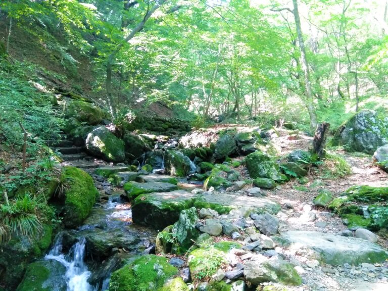
The course is called Rock Garden because the mountain is famous for the view of rocks covered with moss. Especially in the summer, you can see the deep green color of the moss and grass on the trail.
Course Map
1. Mitake Station 御嶽駅
2. Cable-shita Bus Stop ケーブル下バス停
3. Entrance of the Trail 御嶽神社 二の鳥居
4. Mitake Visitor Center 御岳ビジターセンター
5. Shop & Cafe Korisan 山楽茶屋 古狸山
6. Zelkova Tree 御岳の神代ケヤキ
7. Mount MItake Shop Street 御岳山商店街
8. Zuishin-mon Gate 随身門
9. Musashi Mitake Shrine 武蔵御嶽神社
10. Observation Area 奥宮遥拝所
11. Tea Shop 長尾茶屋
12. Observation Area 長尾平展望台
13. Nanayono Falls 七代の滝
14. Tengu-iwa Boulder 天狗岩
15. Rock Garden ロックガーデン
16. Ayahiro Falls 綾広の滝
17. Chair-shaped Cedar 天狗の腰掛け杉
18. Cable Car Mitakesan Station 御岳山駅
19. Cable Car Takimoto Station 滝本駅
Course Map (Google Map)
【External Links】
・Mitake Area Hiking Course Map (PDF・Japanese)
・Cable Car Timetable
