Tokyo Hiking Course Guide
東京日帰り登山・コースマップ|逗子・鷹取山
Average Time: 3 hours
Distance: 5.5 km
Elevation: 139 m
Level: Upper Beginner
About the Course – Takatori Mountain
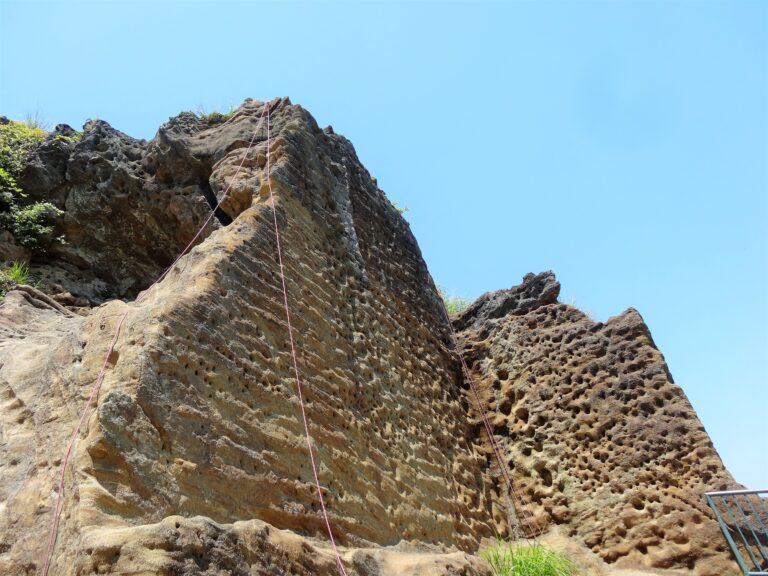
Mount Takatori is located in Zushi City in Kanagawa prefecture. It’s a very small rocky mountain, which used to be a quarry. The place is famous for a steep quay and a statue of Buddha carved on a wall. You can see Sagami bay below your eyes from the top of the mountain.
There are some bad footing on the trail, but the mountain is only 139 meters high and its course suits for beginners.
Course Map
1. Higashi-Zushi Station 東逗子駅
2. Entrance of the Trail 鷹取山登山口
3. Jimmu-ji Temple Bell 神武寺の晩鐘
4. Jimmu-ji Gate 神武寺山門
5. Yakushi Hall 神武寺薬師堂
6. Entrance of the Trail 山道入り口
7. Observation Deck 展望台
8. Resting Place 公園広場
9. Takatori Mountain Park 鷹取山公園
10. Carved Buddhist Image on a Rock Face 鷹取山の磨崖仏
11. Site of Ikekoishi Quarry 池子石の石切場跡
12. Ikeko Shrine 池子神明社
13. Tosho-ji Temple 東昌寺
14. Jimmuji Station 神武寺駅
