Tokyo Hiking Course Guide
東京日帰り登山・コースマップ|奥多摩湖
Average Time: 5 hours
Distance: 10 km
Level: Upper Beginner
About the Course – Lake Okutama
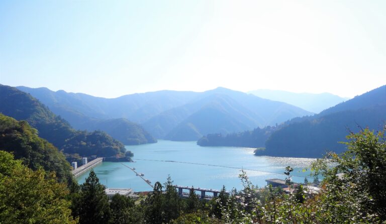
Lake Okutama is located in the west side of Tokyo. The lake lies above Ogochi dam.
The course starts from Okutama station and goes along Tama river to the lake. In the middle of the course there are two suspension bridges. You can see fine views of the river from the bridges.
The course is long, but it’s well-maintained and suits for beginners.
Course Map
1. Okutama Station 奥多摩駅
2. Hikawa Big Bridge 氷川大橋
3. Entrance of Okutama Old Path 奥多摩むかし道入口
4. Fudo Water Falls 不動の滝
5. Shirahige Shrine 白髭神社
6. Sogaku Temple 惣岳不動尊
7. Shidakura Bridge しだくら橋
8. Old Horse Water Trough 馬の水飲み場
9. Dodokoro Bridge 道所橋
10. Entrance of the Trail 山道入り口
11. Aomedachi-fudoson Temple 青目立不動尊
12. Observation Deck 展望台
13. Entrance of Mizunesawa Path 水根沢口
14. Okutama Water and Green Friendship Hall 奥多摩水と緑のふれあい館
15. Ogouchi Dam 小河内ダム
16. Okutamako Bus Stop 奥多摩湖バス停
Course Map (Google Map)
【External Links】
・Okutama Mukashimichi Old Path Course Map (PDF・Japanese)
・Okutama Tourist Office (Japanese)
・Bus Timetable – Okutamako (Lake Okutama) Bus Stop
