Tokyo Hiking Course Guide
東京日帰り登山・コースマップ|陣馬山・明王峠
Average Time: 5 hours
Distance: 13 km
Elevation: 855 m
Level: Intermediate or Upper Beginner
About the Course – Mt. Jimba & Myoo Pass
Mount Jimba (Jimba-san) is located in Sagamihara city, Kanagawa prefecture.
The course starts from Sagamiko station and goes up to Myoo pass. After Myoo pass, you walk along a mountain ridge to the top of Mt. Jimba.
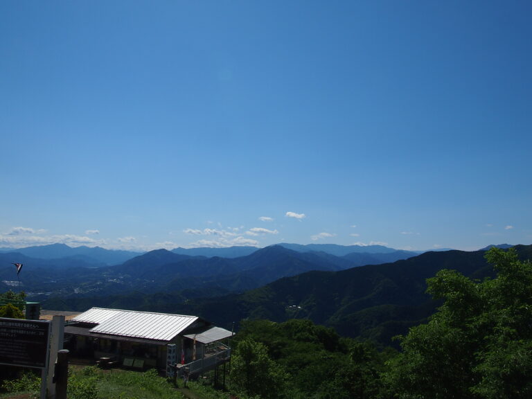
The summit of Mt. Jimba is a famous spots for panoramic mountain view. You can see a nice moutain view from it.
The course is long and goes through the summits of some mountains. It could be tough for beginners, but the course is well-maintained and popular from children to elderly people.
Course Map
1. Sagamiko Station 相模湖駅
2. Stone Memorial 明治天皇碑
3. Jigan-ji Temple 慈眼寺
4. Yose Shrine 与瀬神社
5. Mount Mago-yama 孫山
6. Myoo Pass 明王峠
7. Narako Pass 奈良子峠
8. The Summit of Mt. Jimba 陣馬山山頂
9. Entrance of Ichino-one Trail 一ノ尾根入口
10. Observation Area 一ノ尾テラス
11. Sawai Post Office 沢井簡易郵便局
12. Jimba Tozanguchi Bus Stop 陣馬登山口バス停
13. Sawai River Park 澤井川公園
14. Fujino Station 藤野駅
Course Map (Google Map)
