Tokyo Hiking Course Guide
東京日帰り登山・コースマップ|高尾山6号路
Average Time: 3 hours
Distance: 8 km
Elevation: 599 m
Level: Beginner
About the Course – Mt. Takao
Mount Takao is one of most famous sightseeing spots in Tokyo. Many tourists and local people visit this mountain for a day hike.
In this mountain, there are 7 hiking courses. Each course has a different feature. For example, the 1st trail is the main course of the mountain. Most hikers take this trail. This trail is all paved and there are some shops, restaurants, temples and shrines on the trail. It’s like more touristic course.
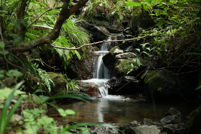
The trail No.6 is not paved, so it’s like a more mountain trail. You can feel nature on this trail. The most interesting part of the trail is a stream trail called “Tobiishi”. You walk in a very tiny and narrow stream by stepping on stones.
On this page, I introduce a model course; Trail No.6 on the way to the top of mountain and Trail No.1 on the way back.
Course Map
1. Takaosanguchi Station 高尾山口駅
2. Stone Statues of Jizo 洗心地蔵尊
3. Entrance of Trail No.6 高尾山6号路入口
4. Biwa Fall 琵琶滝
5. Oyama Bridge 大山橋
6. Stepping Stones 飛び石
7. The Summit of Mt. Takao 高尾山山頂
8. Observation Area 高尾山大見晴台
9. Yakuoin Shrine 薬王院飯縄権現堂
10. Yakuoin Temple 薬王院本堂
11. San-mon Gate 薬王院山門
12. Gongen Tea Shop 権現茶屋
13. Buddhist Stupa 佛舎利奉安塔
14. Otokozaka Slope 男坂
15. Joshin-mon Gate 浄心門
16. The Oldest Cedar たこ杉
17. Cafe & Shop Misuka 高尾山スミカ
18. Takaosan Cable Car Station 高尾山駅
Course Map (Google Map)
【External Links】
・Info about Mt. Takao Area
・Takao Magazine (Course Map & Japanese Info)
