Tokyo Hiking Course Guide
東京日帰り登山・コースマップ|陣馬山
Average Time: 5 hours
Distance: 13 km
Elevation: 855 m
Level: Intermediate or Upper Beginner
About the Course – Mount Jimba
Mount Jimba (Jimba-san) is located on the boundary between Tokyo and Kanagawa prefecture.
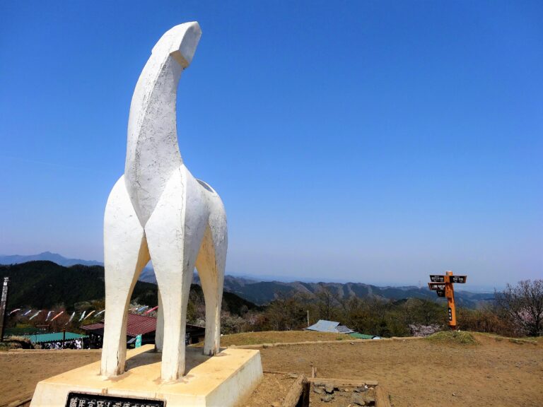
The summit of Mt. Jimba is a famous spots for panoramic mountain view. You can see a nice moutain view from it.
Course Map
1. Fujino Station 藤野駅
2. Fujino Shrine 藤野神社
3. Sawai River Park 澤井川公園
4. Jimba Tozanguchi Bus Stop 陣馬登山口バス停
5. Observation Area 一ノ尾テラス
6. The Summit of Mt. Jimba 陣馬山山頂
7. Entrance of Tochiya-one Trail 栃谷尾根入口
8. Exit of The Trail 登山道出口
9. Resting Place 栃谷園地休憩所
10. Sawai Post Office 沢井簡易郵便局
11. Sawai Tunnel 沢井トンネル
Course Map (Google Map)
