Tokyo Hiking Course Guide
東京日帰り登山・コースマップ|氷川渓谷
Average Time: 3 hours
Distance: 4 km
Elevation: 507 m
Level: Beginner
About the Course – Hikawa Gorge & Mount Atago
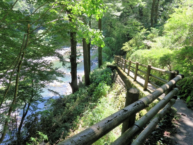
Hikawa Vallery (Gorge) is located in Okutama area, the west side of Tokyo. It’s very close to Oku-Tama station. The valley is popular for the view of autumn leaves in the fall, and a camp site in the summer.
The course starts from Oku-Tama station and goes along Hikawa valley to the forest trail. After the forest trail, the course goes up to the top of a small mountain called Atago-san (Mount Atago).
The course has a variety from a river side trail and a forest trail to mountain trail. The mountain is not high and the course is well-maintained. It suits for beginners.
Course Map
1. Oku-Tama Station 奥多摩駅
2. Kita-Hikawa Bridge 北氷川橋
3. Entrance of Hikawa Riverside Trail 氷川渓谷遊歩道入り口
4. Hikawa Small Bridge 氷川小橋
5. Hikawa Gorge 氷川渓谷
6. Toke Bridge 登計橋
7. Entrance of Toke Trail 登計トレイル入口
8. Toke Observation Area 登計トレイル眺望広場
9. Visitor Station 2 ステーション2
10. Atago Shrine 愛宕神社
11. Stairs of Atago Shrine 愛宕神社階段
12. Showa Bridge 昭和橋
13. Okuhikawa Shrine 奥氷川神社
Course Map (Google Map)
【External Links】
・Hikiwa Valley Hiking Course Map (PDF・Japanese)
・Okutama Visitor Center (Japanese)
